


Voting District 214, Douglas County, Washington
About
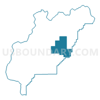
Outline

Summary
| Unique Area Identifier | 684102 |
| Name | Voting District 214 |
| County | Douglas County |
| State | Washington |
| Area (square miles) | 128.22 |
| Land Area (square miles) | 127.49 |
| Water Area (square miles) | 0.74 |
| % of Land Area | 99.43 |
| % of Water Area | 0.57 |
| Latitude of the Internal Point | 47.72848660 |
| Longtitude of the Internal Point | -119.45954740 |
Maps


Graphs
Select a template below for downloading or customizing gragh for Voting District 214, Douglas County, Washington


Neighbors
Neighoring Voting District (by Name) Neighboring Voting District on the Map
- Voting District 207, Douglas County, WA
- Voting District 213, Douglas County, WA
- Voting District 308, Douglas County, WA
- Voting District 309, Douglas County, WA
- Coulee City Rural East Voting District, Grant County, WA
- Coulee City Rural West Voting District, Grant County, WA
- Water: Banks Lake, Grant County, WA
Top 10 Neighboring County Subdivision (by Population) Neighboring County Subdivision on the Map
- Bridgeport CCD, Douglas County, WA (6,499)
- Waterville CCD, Douglas County, WA (2,224)
- Coulee City CCD, Grant County, WA (1,431)
Top 10 Neighboring Unified School District (by Population) Neighboring Unified School District on the Map
Top 10 Neighboring State Legislative District Lower Chamber (by Population) Neighboring State Legislative District Lower Chamber on the Map
Top 10 Neighboring State Legislative District Upper Chamber (by Population) Neighboring State Legislative District Upper Chamber on the Map
Top 10 Neighboring 111th Congressional District (by Population) Neighboring 111th Congressional District on the Map
Top 10 Neighboring Census Tract (by Population) Neighboring Census Tract on the Map
- Census Tract 9501, Douglas County, WA (6,499)
- Census Tract 101, Grant County, WA (3,638)
- Census Tract 9502, Douglas County, WA (2,224)